GPS dans l’agriculture – une technologie en évolution rapide
La technologie GPS (Global Positioning System) existe depuis longtemps, mais l’utilisation du GPS dans l’agriculture est assez récente. La capacité de localiser une position géographique à l’aide de satellites a été introduite pour la première fois dans les années 1970. Cependant, le GPS est vraiment juste la technologie de base. Il a énormément évolué vers l’échange de données en temps réel, ce qui a probablement contribué le plus à son application pratique dans l’agriculture.
Ce n’est qu’à partir d’une autre couche de technologie, à savoir les systèmes d’information géographique, que nous avons vu l’information GPS fonctionner. Le SIG utilise le GPS et incorpore une technologie de base de données hautement sophistiquée, qui se traduit par une utilisation pratique. Certaines technologies connexes comprennent la télédétection et l’imagerie à distance grâce à laquelle vous pouvez utiliser la photographie infrarouge et infrarouge-proche pour analyser l’état d’un champ ou d’une culture sur le terrain en raison de sa réfraction de la chaleur (habituellement couleur du sol, stress des cultures et autres mesures).
La capacité de base de mesurer une image statique à tout moment, combinée à une base de données sophistiquée avec des informations relatives à l’image et à sa mesure; Cela nous a permis non seulement de savoir si votre culture est malade ou carencée en nutriments, mais maintenant de se lier directement à la machine sur le terrain pour fournir le bon taux d’engrais ou de pesticide à une précision incroyable.
Le terme général décrivant cette tendance est Precision Agriculture. Avec des engrais (et certains produits phytosanitaires); le terme “Technologie à Taux Variable“, ou VRT, a énormément évolué au cours des 20 dernières années.
Un terme inventé il y a longtemps, avec l’avènement des tous premiers ordinateurs, était «Garbage In Garbage Out» (GIGO) … donc, afin d’être assuré que les données soient transmises et la traduction résultante à l’équipement sur le terrain est précis, il doit encore y avoir une étape de vérification … et ceci, le plus souvent, est fait par de bons «humains» démodés.
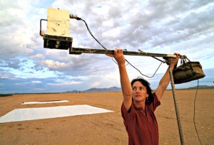
A Soil Scientist obtains baseline digital readings during aircraft or satellite observations Source: USDA
With nearly all of the different measures, there is usually some degree of ground-verified data that must be matched to it; then repeatable characteristics are discovered, and using known research-based response data; a recommendation can be made.
GPS in Agriculture also democratized Databases for farmers
The USDA, for example, has a program called CropScape‘ which shows several layers of data relative to cropland across the country. This interactive technology is driven by GPS and Remote Sensing technology. This highly sophisticated ‘Remote Mapping’, available on the internet and on ‘the cloud’ is extremely helpful to farmers and researchers alike.
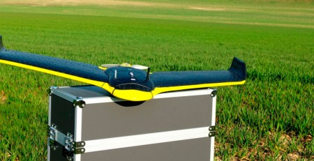
Unmanned Aerial Vehicles (UAV) are perhaps the most rapidly developing technology in commercial agriculture today. Drones are an example of this remote controlled imaging tool, allowing the farmer to precisely monitor crops from above when they’re actively growing in the field before making a management decision. The savings over putting ‘boots on the ground’ to walk the fields, is tremendous. Tied in with sophisticated spatial resolution software, with information relating to tests or activities, or historical yields; can provide another tool to maximizing profits and yields while reducing over-application of synthetic fertilizers and crop protectants.
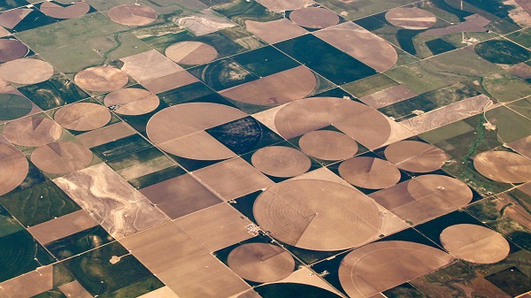
Here’s an image of Center-pivot Irrigation impact using a Landsat satellite. These images record the relative ‘greenness’ of the crop below, allowing for the farmer to evaluate his crops from high above.| Image credit: NASA
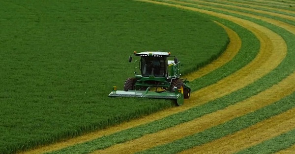
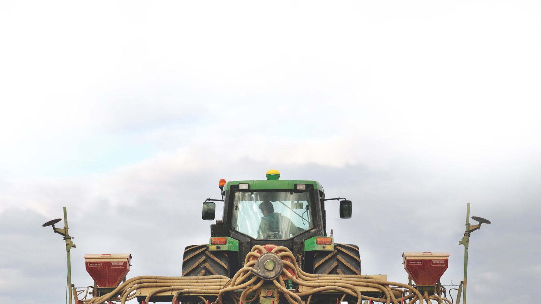
Data collected against a GPS grid crosses any area a crop scout might evaluate. Disease, insect, fertility, weeds, drainage, and more…recorded, then a recommended response programmed in, and the tractor operator can see at a glance when they are in a grid that needs attention.
There are even infrared sensors that can evaluate the crop ‘on-the fly’, mounted on the tractor or equipment itself, and respond accordingly.
Developing Countries Finding the Way to Match their Will
While you might think that all this new technology is limited to large, advanced Ag Systems of Europe, the US, and other developed countries; there are several projects that are bringing this technology and teaching citizens how to apply it in many developing agricultural economies across the world.
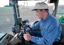
All of these tools, and the ability to precisely control application equipment from the cab of the tractor greatly enhances the ability to manage your crops more precisely.
Image: https://www.gps.gov/applications/agriculture
The Global Development Incubator, an organization dedicated to assisting developing countries is dedicated to bringing together like-minded individuals and technologies to assist the more than 2 billion small farm holders across the globe, responsible for feeding the majority of the population in their countries
Precision Agriculture for Development – See their website which has as its ‘byline’ “Precision Agriculture for Development is transforming the way farmers in developing countries receive agricultural advice using research and technology.”
Farming Precisely is Nothing New
Farmers who continually strive to improve their crop yield and quality know how important monitoring of their crops is…soil sampling, crop sampling, knowing pest cycles, and many more steps come together for a healthy bottom line. The evolution of Precision Agriculture is now assisting farmers across the world to more efficiently monitor their crops and soils; so as to make the best decision for their crops and the environment. It’s all relative, as to how much technology and at what cost they can apply it to their specific area and farms.
By: John Deibel
Read more about it:
Future of farming: Driverless tractors, ag robots – CNBC
Farms.com – Precision Agriculture – Remote Sensing
Agriculture Technology: How GIS Can Help You Win the Farm – GIS Geography